![]() +977-01-4544164
+977-01-4544164
![]() 9851167789
9851167789
![]() info.interfaceeng@gmail.com
info.interfaceeng@gmail.com
![]() +977-01-4544164
+977-01-4544164
![]() 9851167789
9851167789
![]() info.interfaceeng@gmail.com
info.interfaceeng@gmail.com
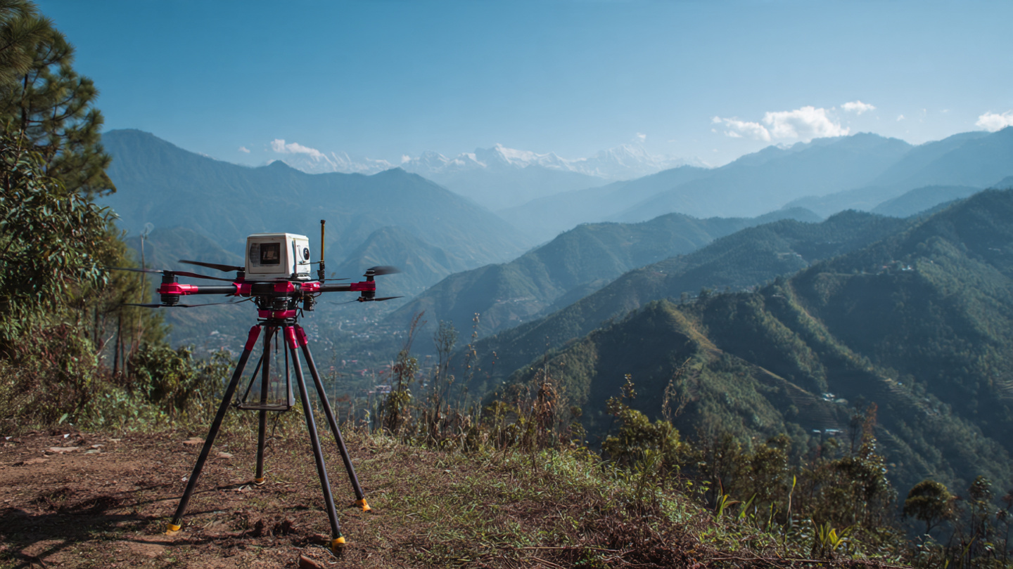
We offer advanced High Precision Drone and LiDAR Survey services, which are critical for infrastructure planning and development across Nepal's challenging terrain. Utilizing RTK/PPK-enabled drones and specialized LiDAR sensors, we capture millions of precise data points to generate highly accurate elevation data, surface features, and detailed terrain models.
This technology is essential for generating centimeter-level accurate outputs like Digital Elevation Models (DEM), contours, and 3D models, making it ideal for engineering design, especially in complex sectors like hydropower, road networks, and urban land development, ensuring projects are planned and executed with unparalleled precision.
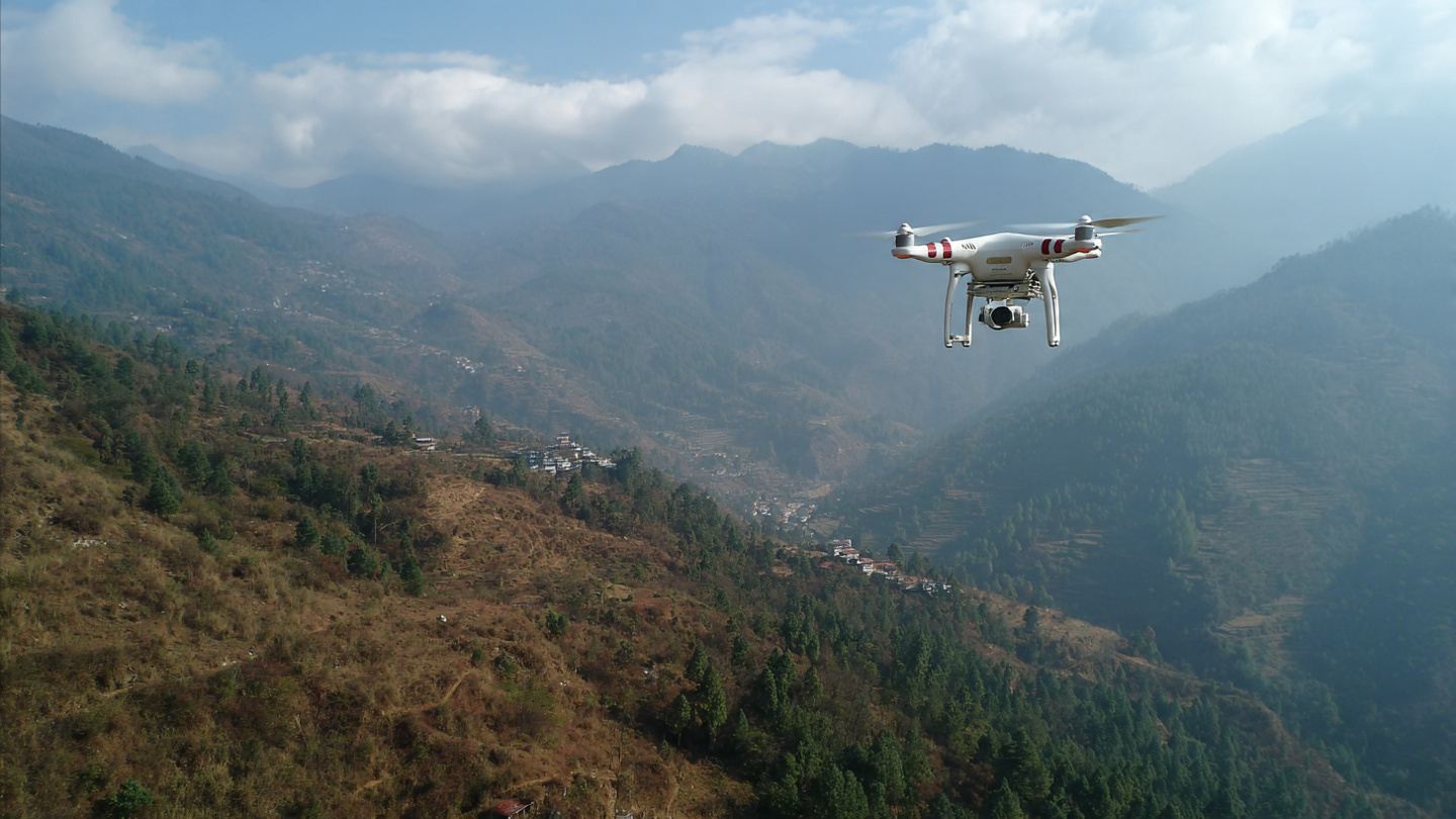
We offer advanced High Precision Drone Survey services tailored for Nepal's complex and mountainous terrain, utilizing RTK/PPK-enabled drones to deliver unparalleled accuracy in data collection. This technology is vital for detailed topographic mapping, 3D modeling, and precise elevation data capture in areas often inaccessible or time-consuming for traditional surveying methods.
Our LiDAR (Light Detection and Ranging) technology uses laser pulses to measure distances to the Earth's surface, creating highly accurate 3D models even in dense vegetation or difficult terrain. This advanced technology captures millions of precise data points to generate detailed terrain models essential for engineering design.
We offer advanced High Precision Drone Survey services tailored for Nepal's complex and mountainous terrain, utilizing RTK/PPK-enabled drones to deliver unparalleled accuracy in data collection. This technology is vital for detailed topographic mapping, 3D modeling, and precise elevation data capture in areas often inaccessible or time-consuming for traditional surveying methods.
Detailed topographic surveys for dam sites, reservoir areas, and transmission line corridors in mountainous regions.
Accurate terrain data for road alignment, cut-fill calculations, and slope stability analysis.
3D city modeling, land development planning, and infrastructure design for urban areas.
Volume calculations, pit monitoring, and reclamation planning for mining operations.
Forest inventory, canopy height models, and environmental impact assessments.
Precision agriculture, crop health monitoring, and irrigation system planning.
RTK/PPK technology ensures centimeter-level precision for critical engineering applications.
Rapid data collection covering large areas in days instead of weeks with traditional methods.
Reduced field time and manpower requirements lower overall project costs significantly.
Access hazardous or inaccessible areas without risking field survey teams.
Generate millions of data points for comprehensive analysis and detailed modeling.
LiDAR technology works effectively even in cloudy conditions and through vegetation.
High-resolution terrain models showing ground surface elevations without vegetation or buildings.
Detailed contour lines at specified intervals for engineering design and planning.
Detailed three-dimensional representations of terrain and infrastructure.
High-density XYZ point data for detailed analysis and modeling in CAD software.
Geometrically corrected aerial imagery with uniform scale and minimal distortion.
Accurate cut-fill calculations and stockpile volume measurements.
High-precision drones with real-time kinematic positioning for centimeter accuracy.
Advanced laser scanning technology for detailed terrain mapping through vegetation.
Professional aerial cameras for detailed photography and videography.
Industry-leading software for data processing, analysis, and modeling.
Contact us today for high-precision drone and LiDAR survey services that deliver accurate data for your infrastructure projects.